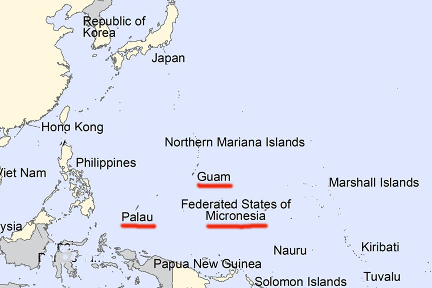
My previous sojourns in the Pacific, last year and the year prior, did not reach the Carolines, an archipelago of some 900+ widely-scattered islands stretching across 2200 miles of the western Pacific north of New Guinea. This trip will remedy that lacuna.
Getting there from Florida takes me five flights: two to the west coast, then across the ocean to an Asian gateway, then to a regional transport hub, and finally to the destination.
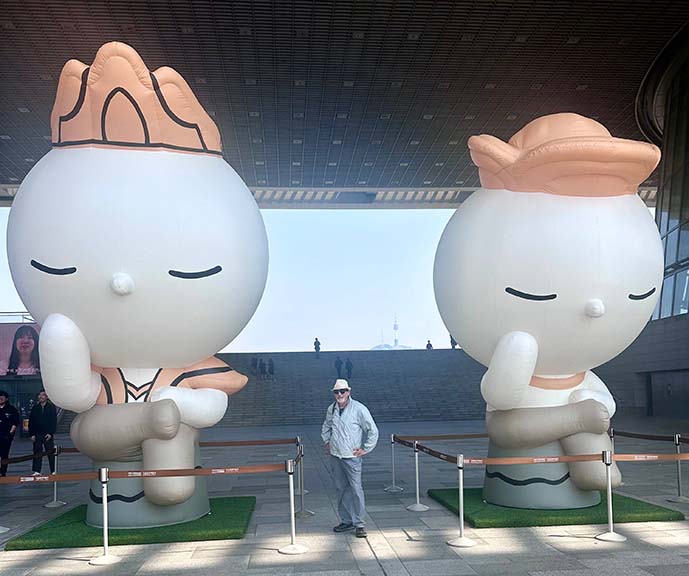
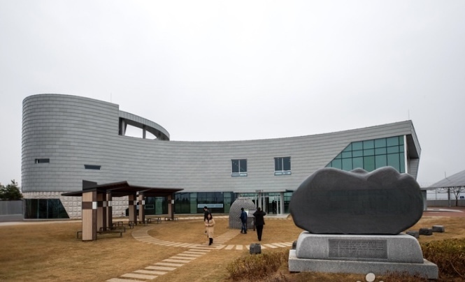
To break up the journey I stop for a day and a night in Seoul, taking the opportunity to visit the Korea National Museum, housed in an expansive new building that postdates my prior brief stopover in 2004.
The next day I continue on to Guam, a US territory that is the largest and southernmost of the Mariana Islands. It is the terminus of United Airlines’ Pacific “Island Hopper” and its “Manila Hopper”, the penultimate stop of both services being Palau.

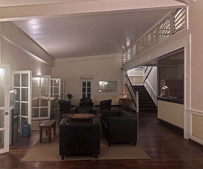
It is nighttime when we land at Koror, the capital and principal city, where I pick up a rental car, and proceed to the Palau Hotel.

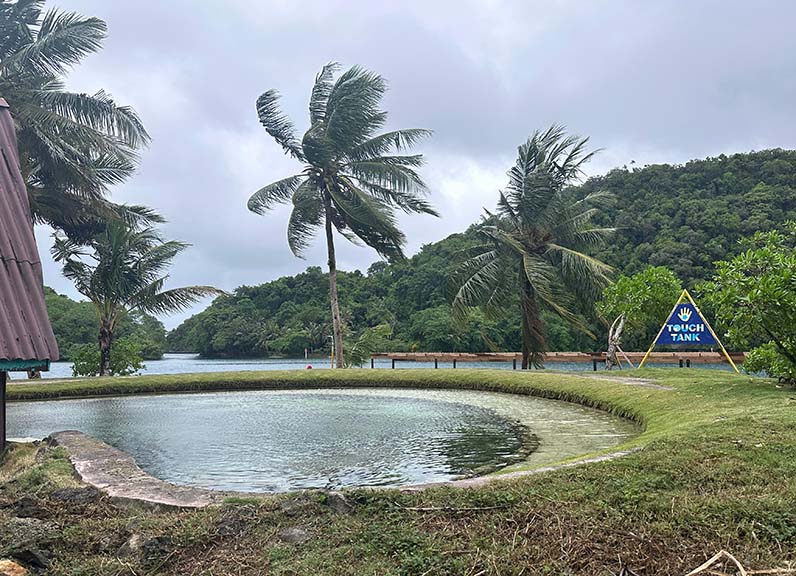
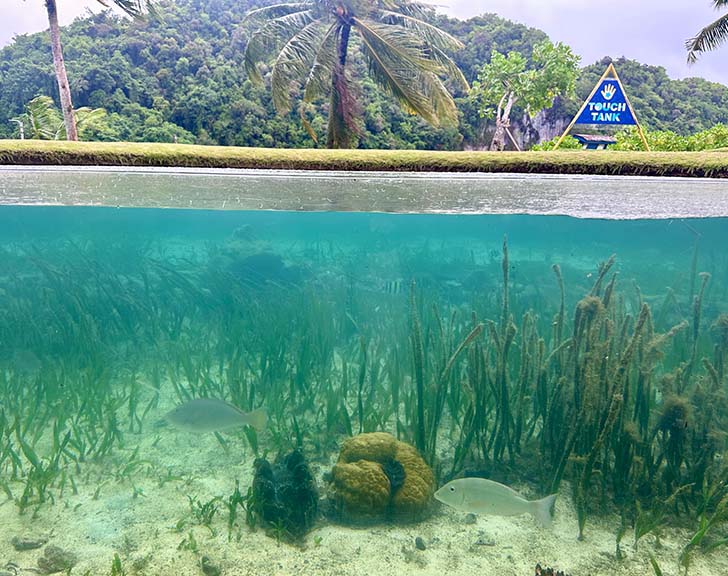
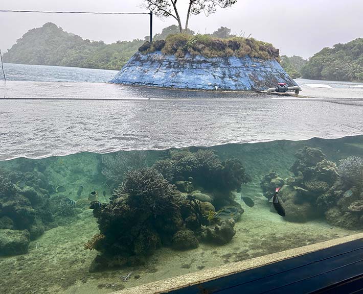
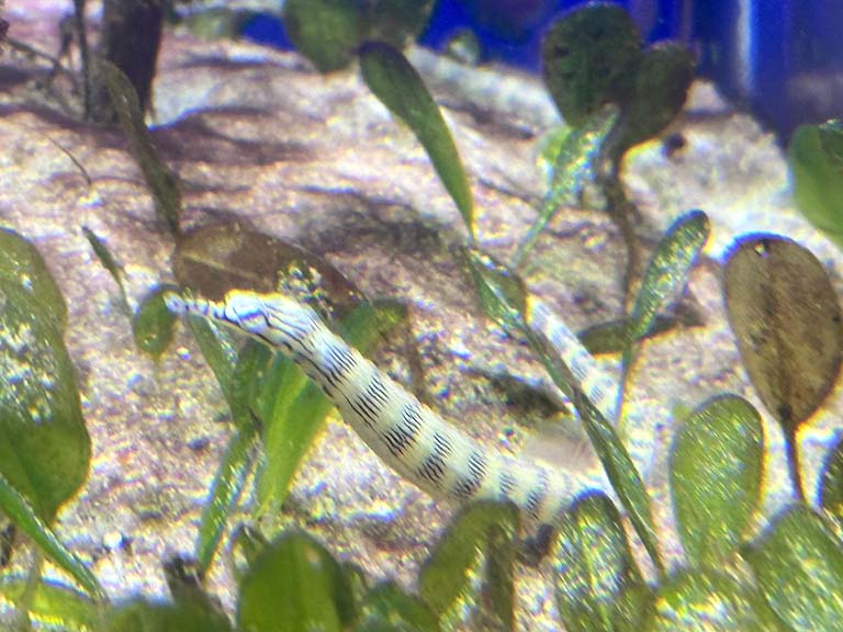
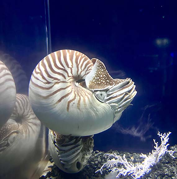
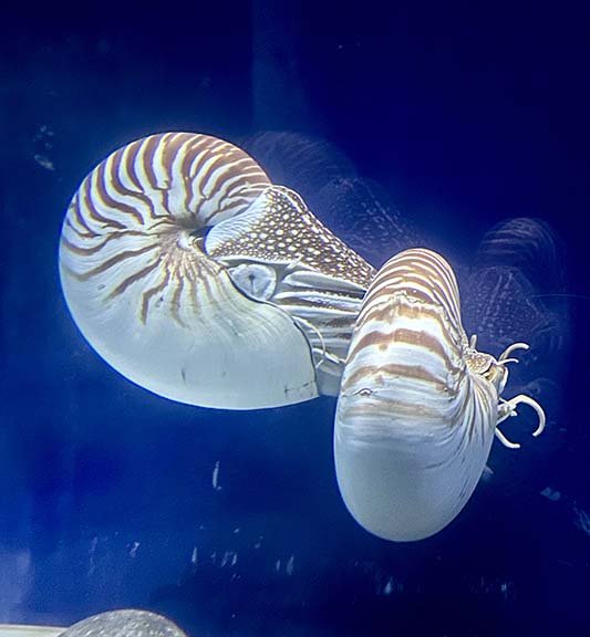
My first day is devoted to island exploration. First stop is the Palau Aquarium. Small but well done, it displays marine habitats in glass-sided outdoor ponds which one can view from both above and below.
|
|
|
|
|
Also, live nautiluses (“nautili”?). They normally live at great depths.
|
|
|
|
|
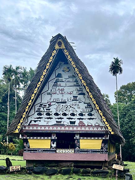
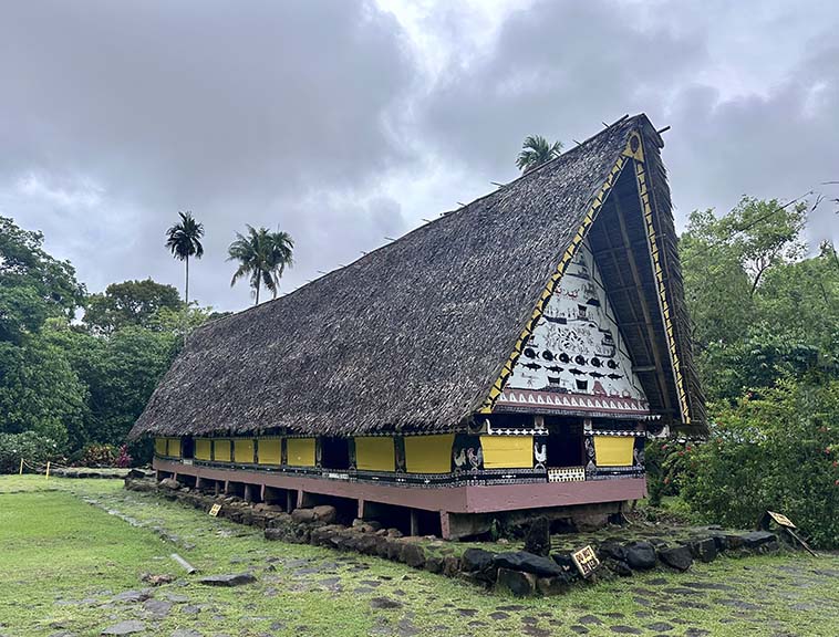
The Palau National Museum was a gift from Taiwan. The connection is twofold: the islands that comprise Micronesia and Polynesia were originally populated by settlers from Taiwan, and Palau is one of few remaining holdouts that recognize the Republic of China instead of the rebels that have ruled the mainland from Beijing since 1949.
For almost 400 years the Carolines were part of the Spanish Empire. Governed from Manila, there was little visitation and no settlement here other than missionaries. After the Spanish-American War, the islands were sold to Germany in 1898. That lasted twenty years until the German Empire was dismembered in 1918. As one of the victors of World War I, Japan then took over.
During their tenure, the Germans made a considerable imprint. They undertook archeological excavations which continue to this day. They also taught the natives to sing this little ditty, which begins:
I don’t like the Spanish because they don’t think about Palau
I like Germany, for its talk is good, it is brave and Palau now is good
It goes on to praise the Kaiser as wise and just, etc.
The next regime was somewhat harsher: students were forced to learn Japanese and forbidden to speak Palauan. The people endured both forced labor for the Japanese and later, frequent bombing by American warplanes. The final chapter: the westernmost Caroline islands rejected joining what became the Federated States of Micronesia and instead opted for independence as the Republic of Palau.

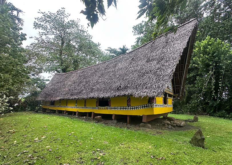
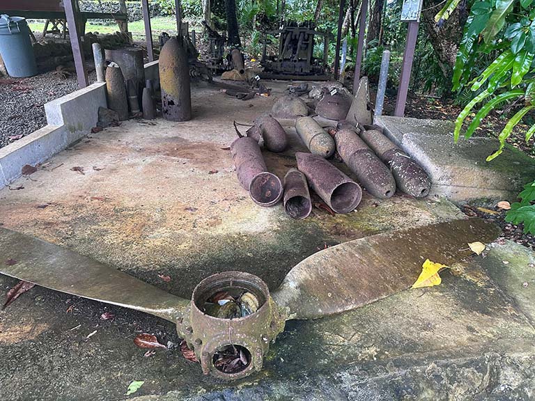
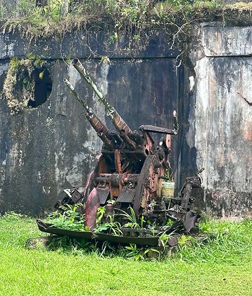
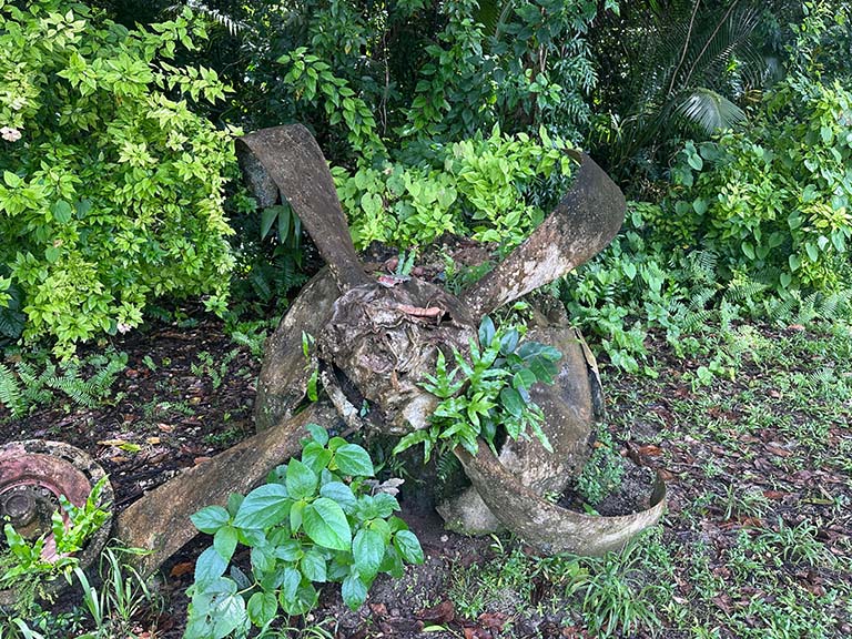
Outside the museum is a reconstructed traditional meeting house and a pile of rusted Japanese military hardware.
|
|
|
|
|
Palau has a total population of 18,000, about two thirds of which live on the small island of Koror. A bridge connects it to the larger but sparsely inhabited island of Babeldaob, where I continue my island tour. Past the airport and not far from the US Embassy is the burnt-out shell of a former Japanese HQ.
|
|
|
And an in situ meeting house.
|
|
|
In the absolute middle of nowhere is the national parliament building, again courtesy of Taiwan.

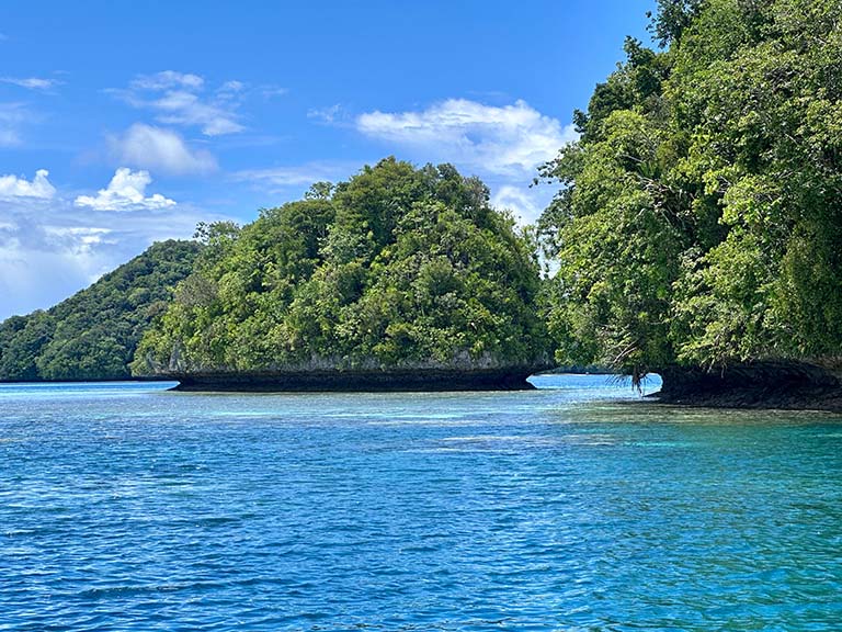
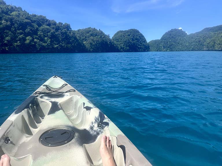
For the next day I sign up for a trip to the Rock Islands, a national park famous for its Jellyfish Lake, whose eponymous denizens, unfortunately, are on a periodic leave of absence. My consolation prize is a refrigerator magnet.

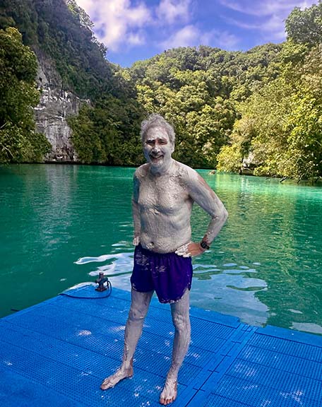
First stop is Milky Way Lagoon, where the thing to do is get slathered in the white mud that comprises the sea bottom. It is supposedly good for the skin.
Then, kayaking among the islets on crystal-clear waters.
|
|
|
|
|
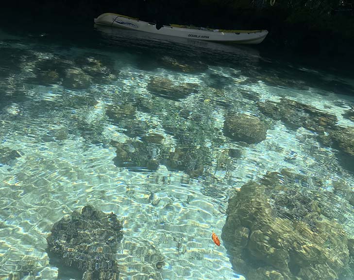
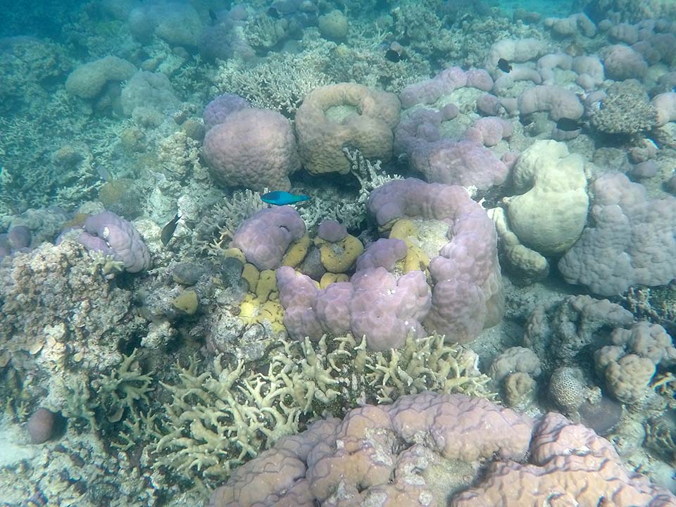
After lunch, three snorkel spots. Good, but in terms of variety and colors of the coral and reef life, inferior to the Maldives.
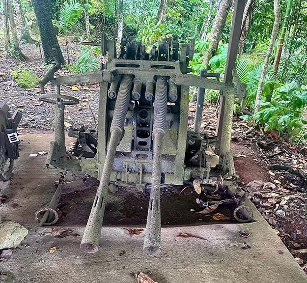
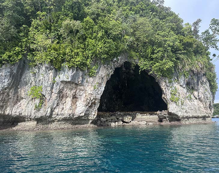
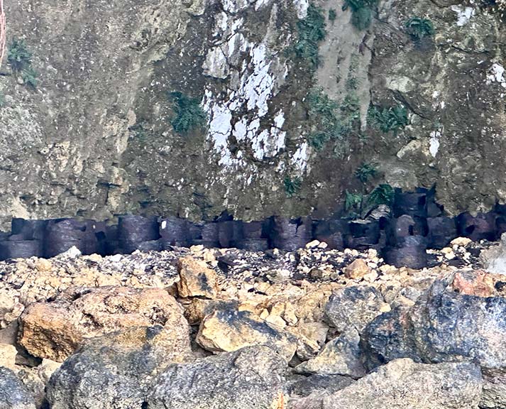
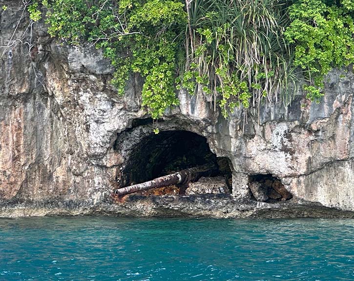
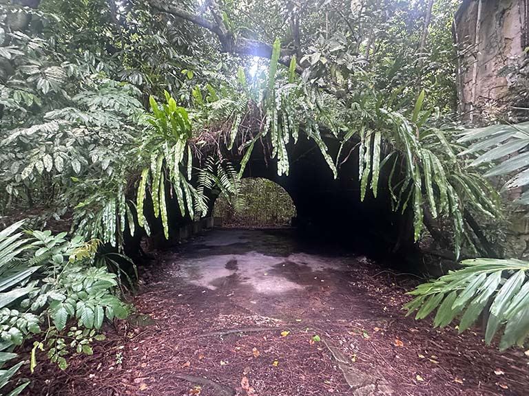
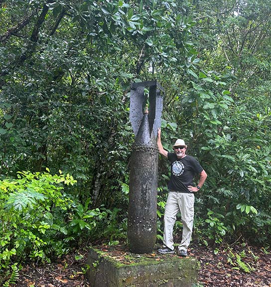
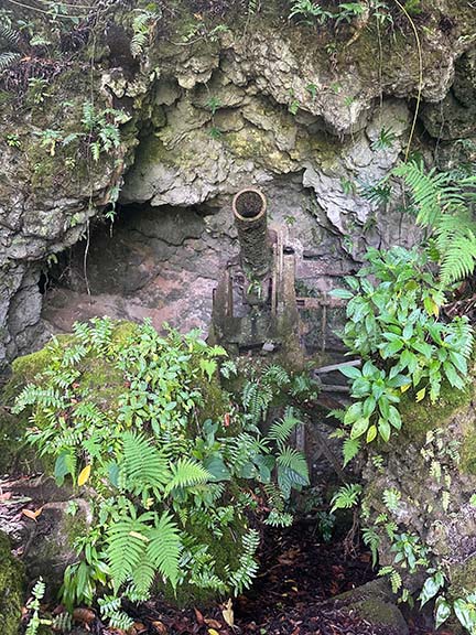
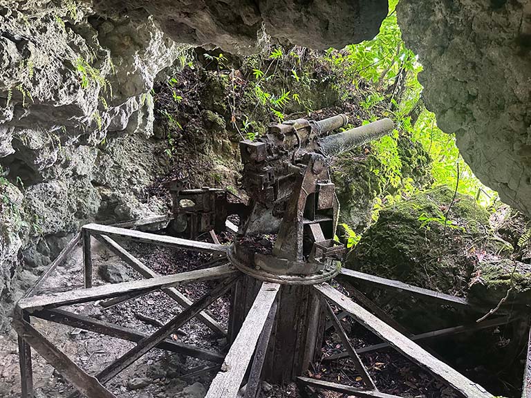
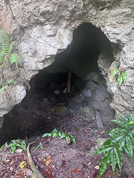
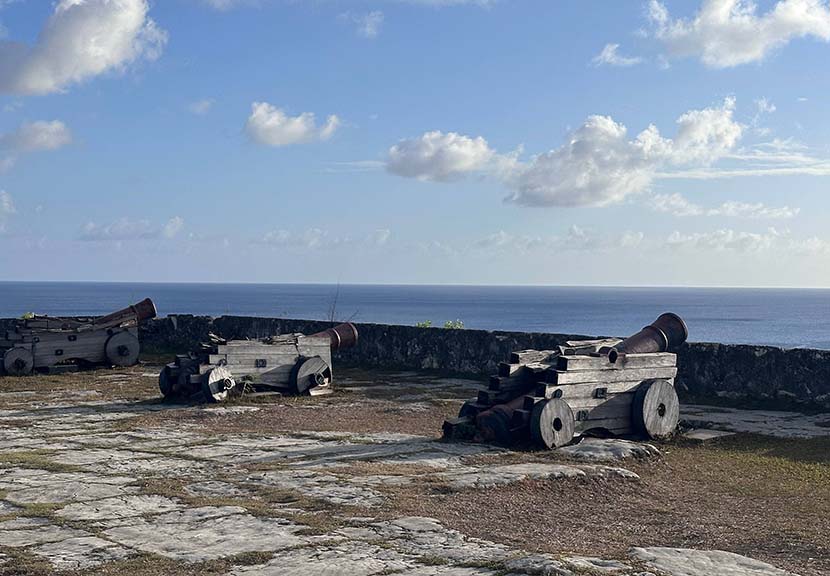
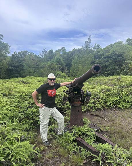
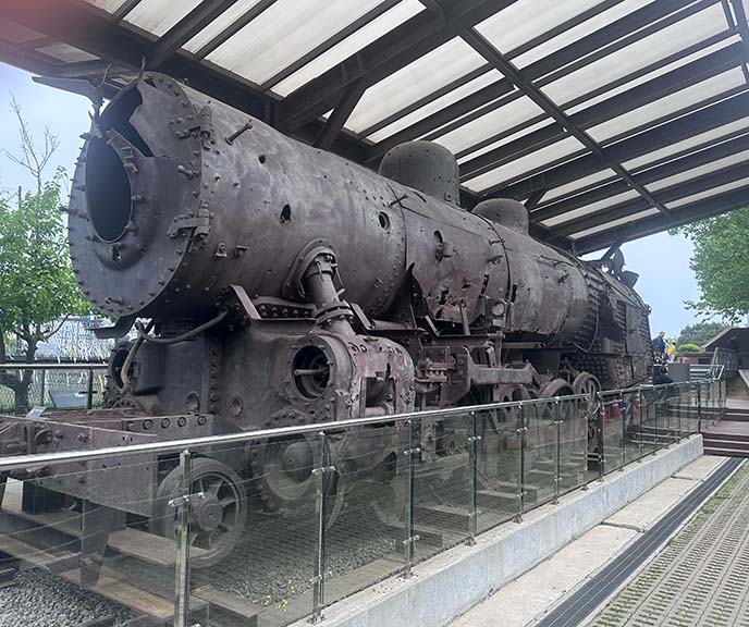
On the way back we pass by a cave that served as a refueling station for Japanese seaplanes. Rusted fuel barrels and an anti-ship cannon.
|
|
|
|
|
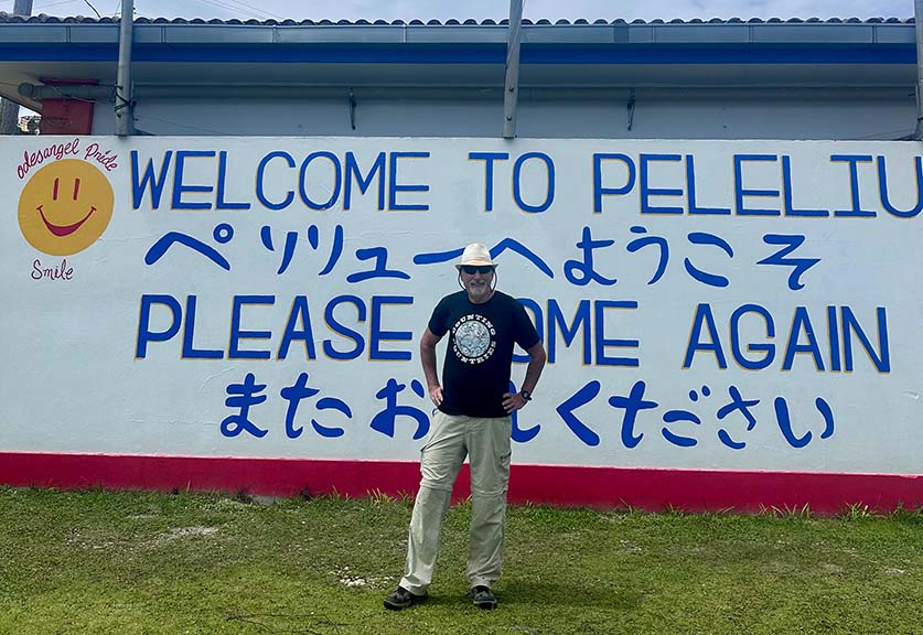
Another day, another expedition. This one is to the tiny island of Peleliu.
By Fall, 1944 the US had gained experience in amphibious assaults; by then the Japanese had also learned many lessons about island defense. The result was that a campaign that was expected to take three days became a struggle that lasted 74 and that the Marines consider their bitterest battle of the war. The 11,000 Japanese fought almost to the last man; the final 34 defenders did not surrender until April the next year.
|
|
|
|
|
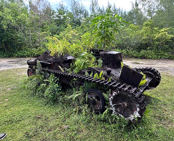
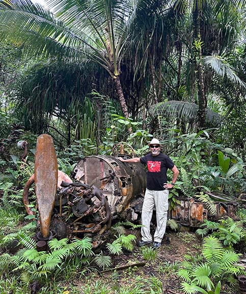
Today, the two by five mile island has about 500 inhabitants. Now covered by dense jungle; after the battle there was not a tree standing. A crashed Japanese Zero fighter plane.
|
|
|
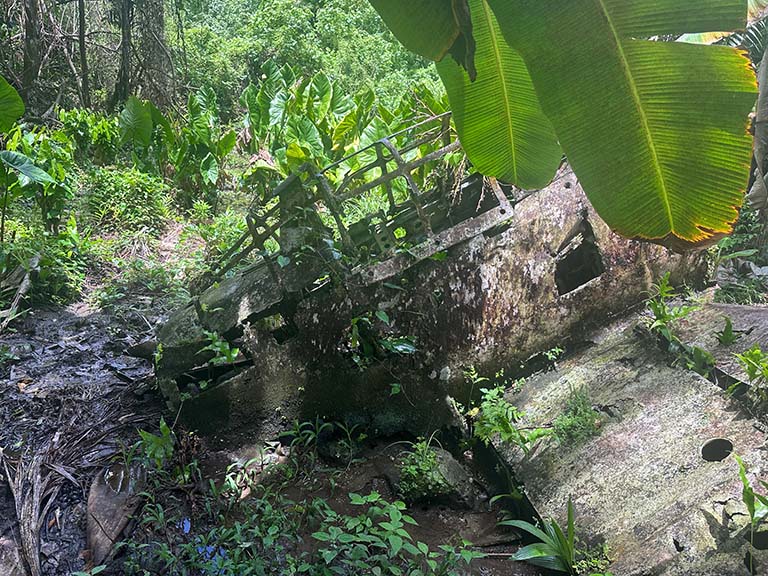
Former Japanese communications center.

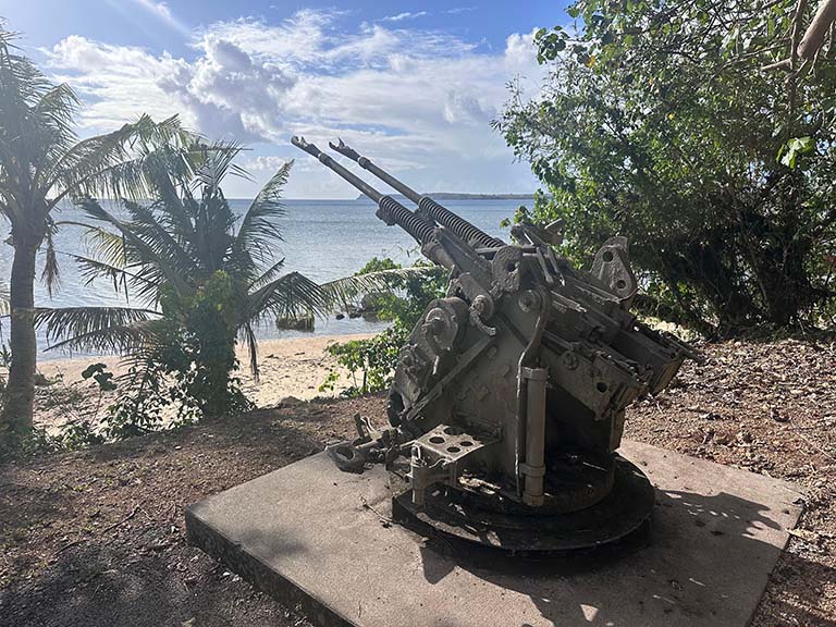
Japanese gun enplacement above Bloody Nose Ridge.
|
|
|
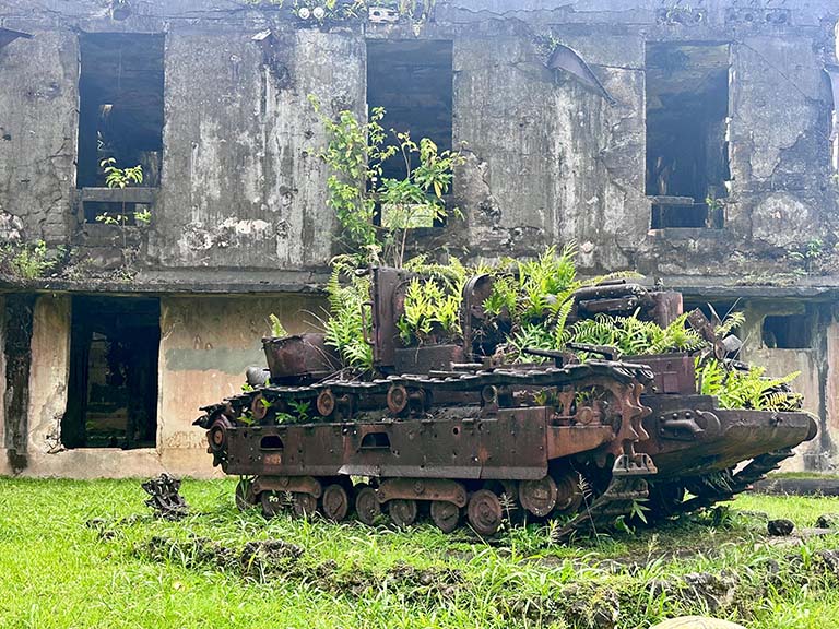
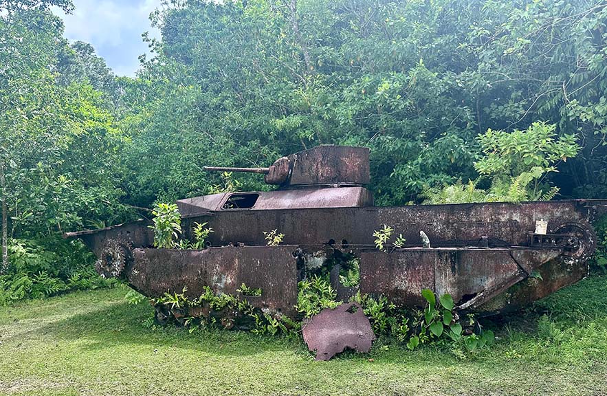
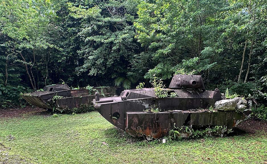
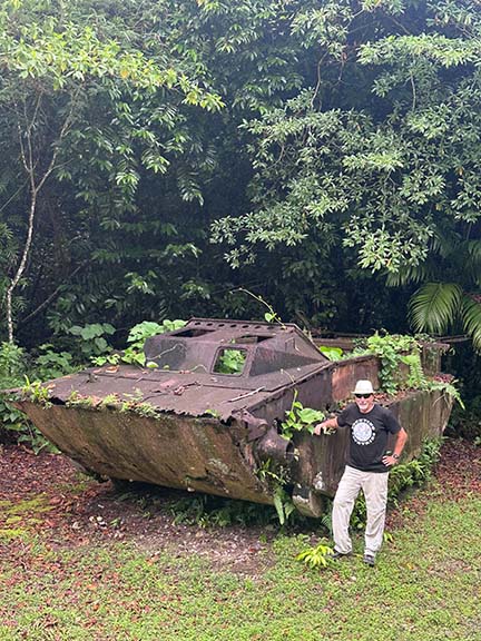
Landing Beach Orange, US amphibious landing craft and tanks.
|
|
|

|
|
|
1000 Man Cave, complete with field hospital, from which its last ten survivors emerged a month after the battle.
|
|
|
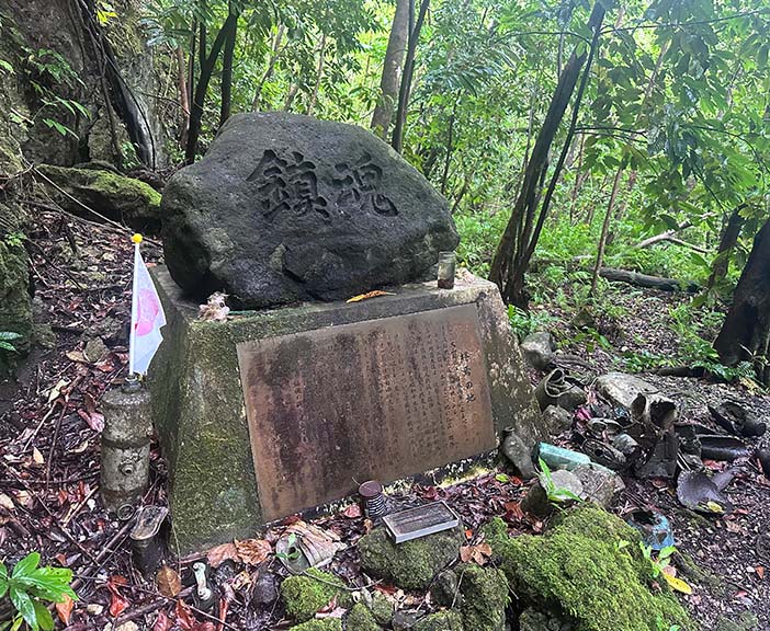
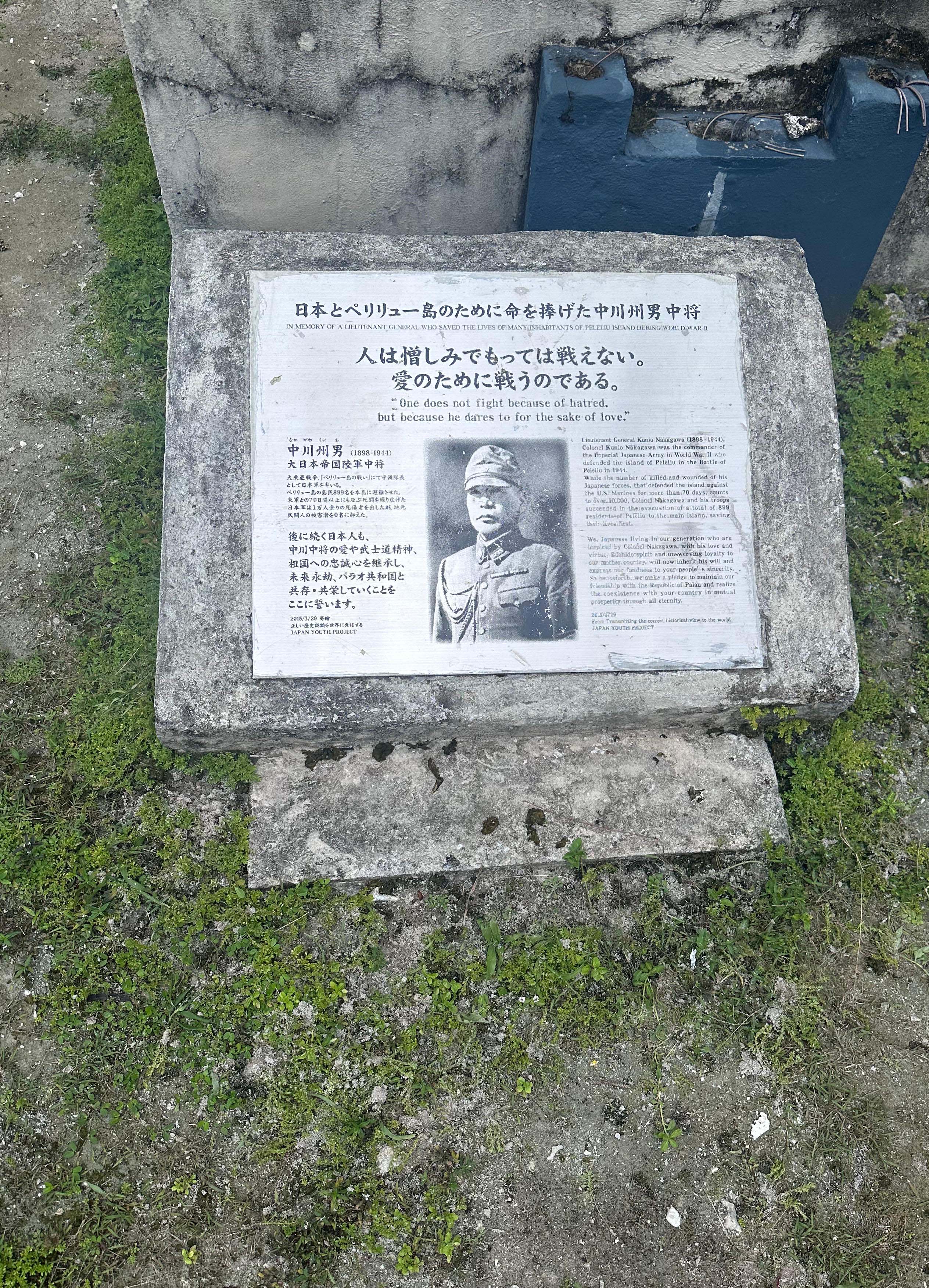
Redoubt where the Japanese commander committed suicide. The cenotaph of the supervising general (his actual grave is unknown) – he is honored because he evacuated the civilian population to Koror prior to the battle.
|
|
|
|
|
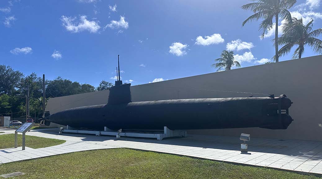
Then, back to Guam (there are few other flight choices), where I take a day to see the sights.
The most interesting to me is the War in the Pacific National Historical Park, comprised of sites of the two Battles of Guam and a visitors’ center. A US territory since 1898, the island had fewer than 500 defenders when, the day after Pearl Harbor, the Japanese attacked in 1941; the returning US forces two years later: 54,000.
|
|
|
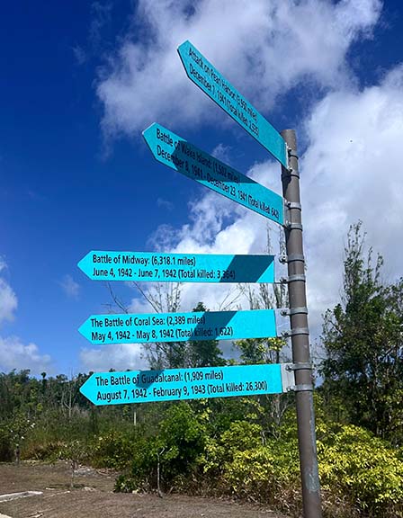
It is a memorial to the entire Pacific theater campaign. This directional sign gives a sense of its vast expanse: Pearl Harbor, 3,950 miles; Wake Island 1,502 miles; Midway 6,318 miles; Coral Sea, 2,389 miles; Guadacanal, 1,909 miles.
Aside from the capital of Hagatna (formerly Agana) and a couple of tiny towns, the island is sparsely populated: one American soldier hid out in a cave for 32 months from the initial surrender of the island until US troops retuned; once they did, a Japanese soldier remained in the jungle for 28 years, refusing to surrender until his former commanding officer flew in from Japan and ordered him to do so.

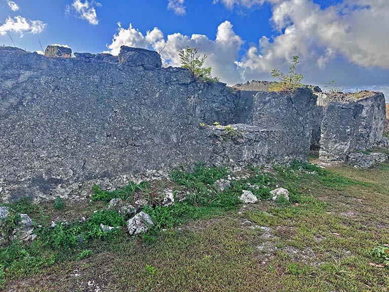
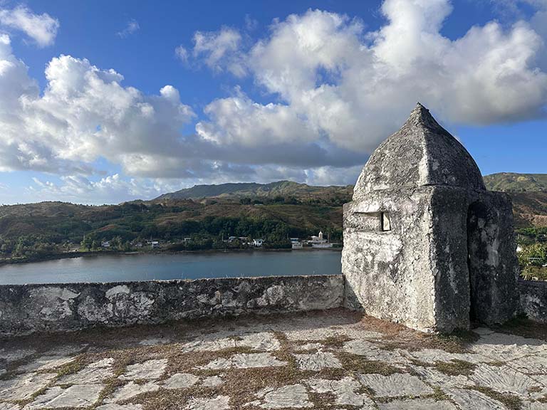
Down the coast is what’s left of a Spanish fort. This was the only watering spot for Spanish ships sailing between Mexico and the Philippines.
|
|
|
|
|
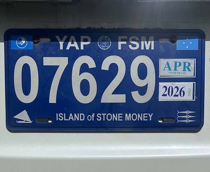
Yap, the island of stone money. I first read about it in elementary school. Now, it will be my touchpoint for country #186.
|
|
|
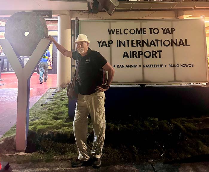
While Palau has a steady stream of Taiwanese tourists, Yap has almost none. About 8,000 people live on Yap and its outer islands. It is one of the Federated States of Micronesia, a former US Trust Territory that, like the Marshall Islands and Palau, continues to use the US Dollar as its currency and has a US Postal Service Zip Code. The only air connection is the twice a week United Airlines flight that arrives at 1:00 AM and departs an hour later.
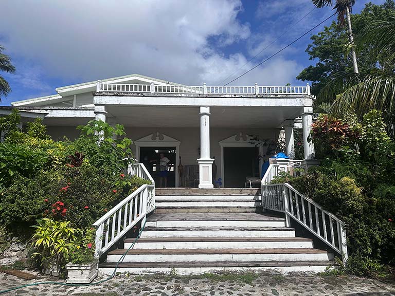
Another arriving passenger and I are the only guests at the grandly named Pacific Dive Resort in Colonia, the tiny principal settlement and capital of Yap State. A very comfortable rambling wooden structure, it is built in the style of tropical colonial architecture a century ago. Its very helpful Chinese manager volunteers to drive us to all parts of this flyspeck island.
|
|
|
|
|
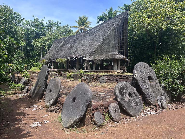
Just out of town is a stone money bank. For centuries giant “coins” were hewed by hand from rock on Palau and brought almost 300 miles here by canoe. The value of each piece was a function of the effort involved in obtaining it. Rather than being moved for each transaction, most were kept in banks where ownership was common knowledge.
|
|
|
|
|
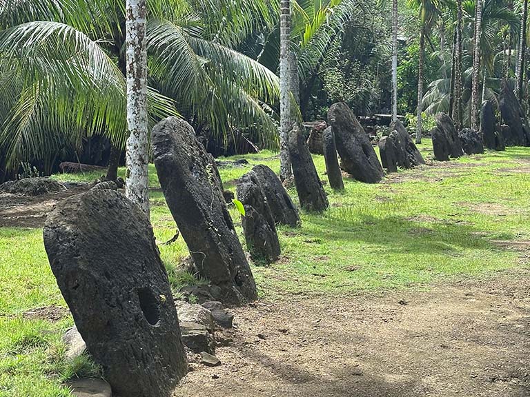
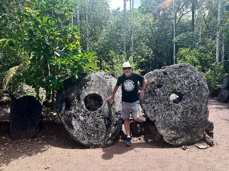
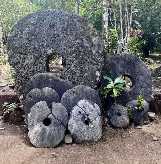
There are several such banks around the island holding the larger stones. Smaller ones are often kept at individual houses, but always on display. (Probably because it would be too lumpy to keep them under your mattress.)
|
|
|
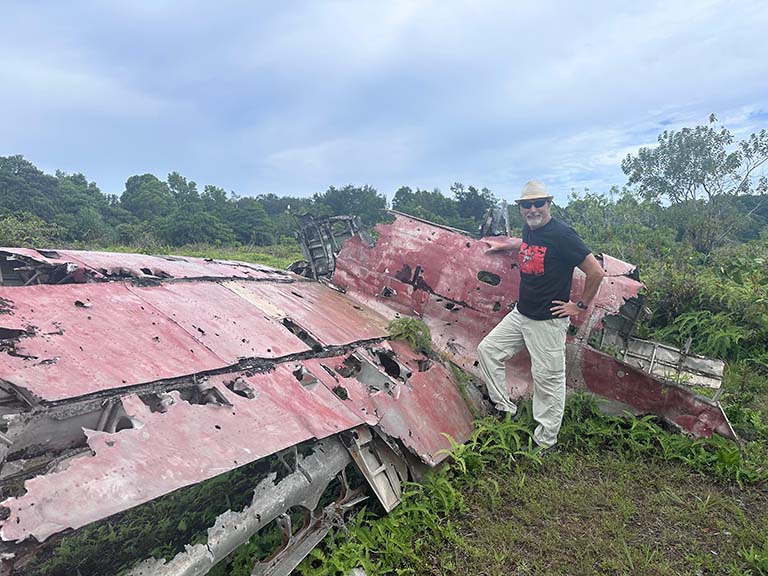
There was no ground fighting on Yap, but the air war claimed claimed almost 40 US planes in what were almost daily raids on the Japanese airfield and installations. Remaining are crashed Zeros, a Nakajima bomber, and an anti-aircraft gun.
|
|
|
|
|
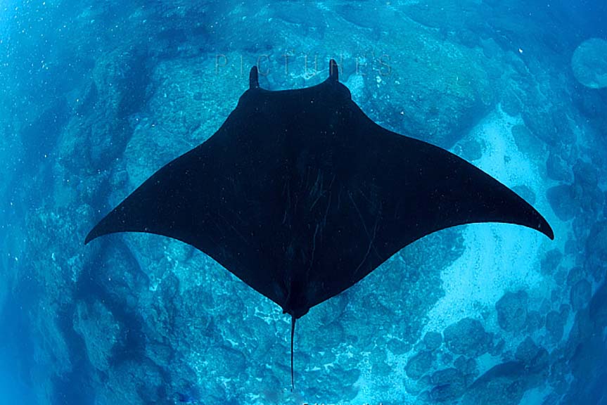
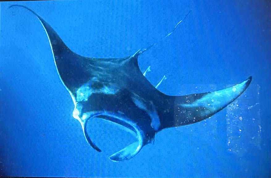
Yap is famed among scuba divers for its resident Manta rays. I’m no diver, but do set forth on a half-day snorkeling trip. I see them, but, unfortunately, the giant critters tend to hang in plankton-rich waters which make for poor photography. By way of illustration, here are some commercial shots that I grabbed off the internet.
|
|
|
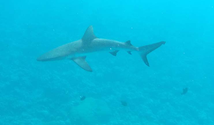
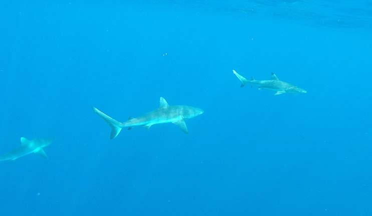
After the Mantas, there is a shark stop and an all-purpose fish locale.
|
|
|
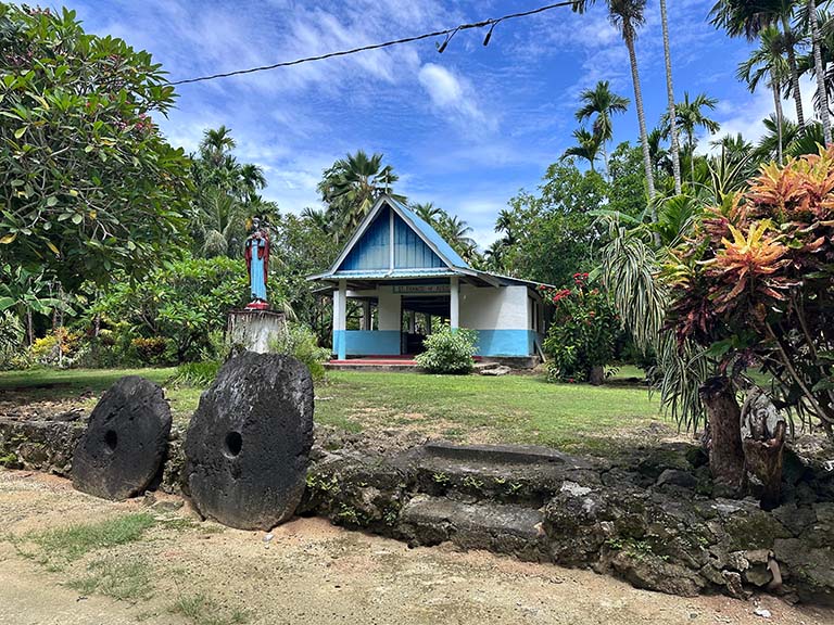
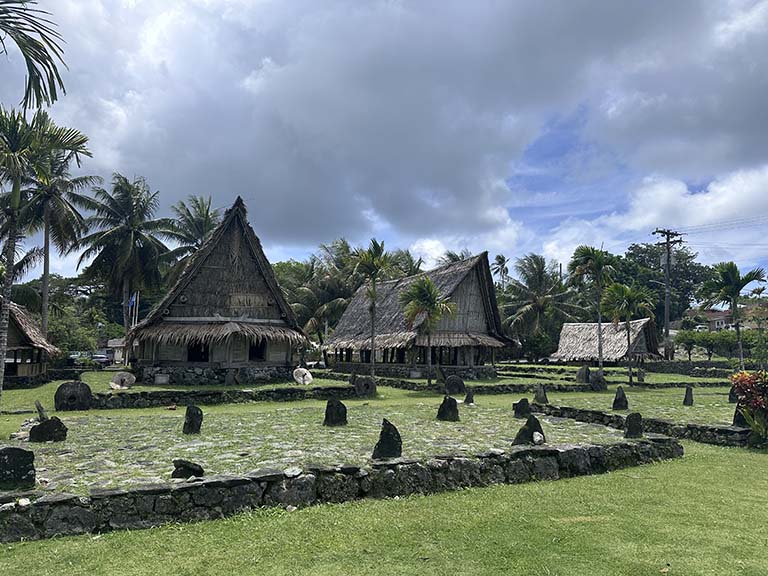
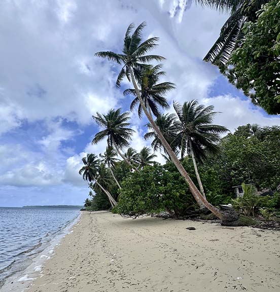
Apart from its unique money, the island has the typical South Seas look and feel (even though Yap is in the Central Pacific, nine degrees north of the equator).
|
|
|
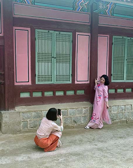
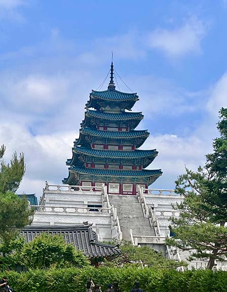
On the return route I have allotted two more days in Seoul. First, the rolls-off-your-tongue Gyeongbokgung Palace, where I arrive just in time for the changing of the guard ceremony.

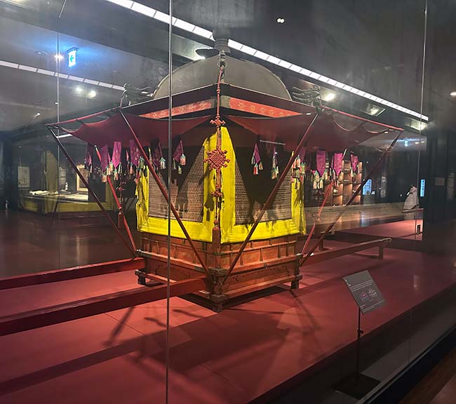
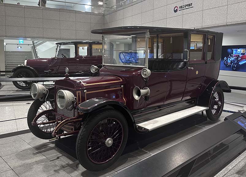
Next to it is the new Palace Museum. The 518 year Joseun dynasty ended in 1910, not by revolution but by subjugation by Japan – thus the monarchy is viewed with nostalgia as a symbol of Korean sovereignty. Its many exhibits include royal transport, from a palanquin to the last Emperor's 5 liter, 31 hp Cadillac and the Empress's Daimler of similar vintage.
|
|
|
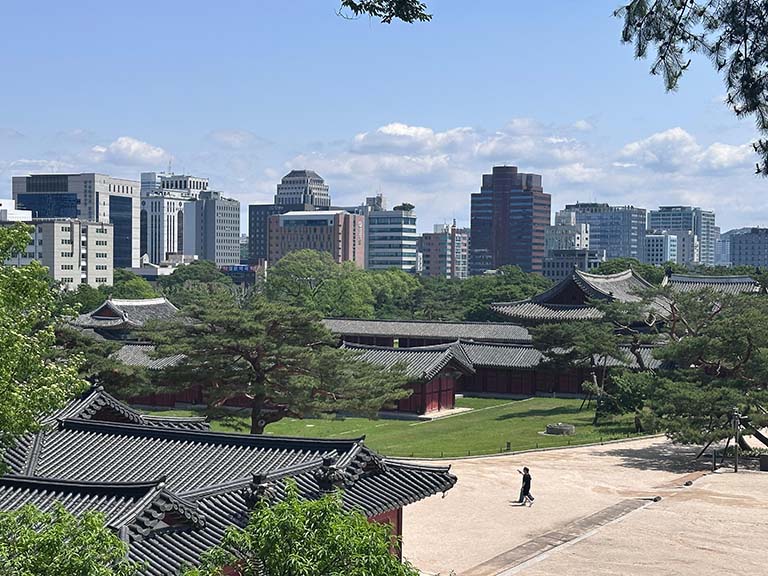
Nearby is the not wildly different Changgyeongung/Changdeokgung (there will be a quiz later on this) palace complex, the actual 20th century residence of the royals. The last Empress died in 1966, and the last remaining prince lived here until 1989.
|
|
|
|
|
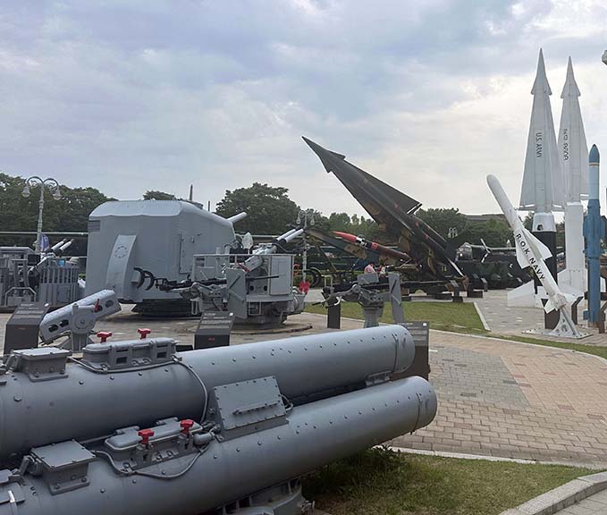
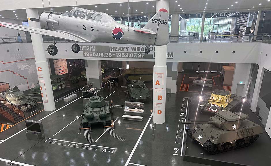
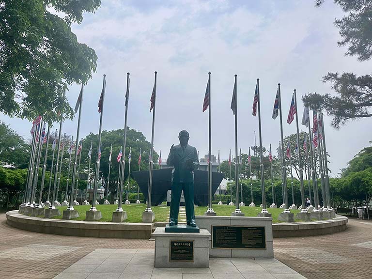
Finally, the vast War Memorial Museum. Last time it was closed the day I was there and I could only visit the outdoor displays.
|
|
|
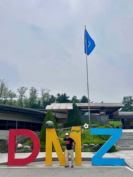
The other thing on my bucket list is the Demilitarized Zone. Last time all tours had been suspended due to military exercises. Now, DMZ tourism is big business – they recently celebrated their 10 millionth visitor.
The bus tour first goes to the Paju tourist complex, a mélange of memorials, restaurants, shops, displays, and amusement park, bordering the DMZ.
|
|
|
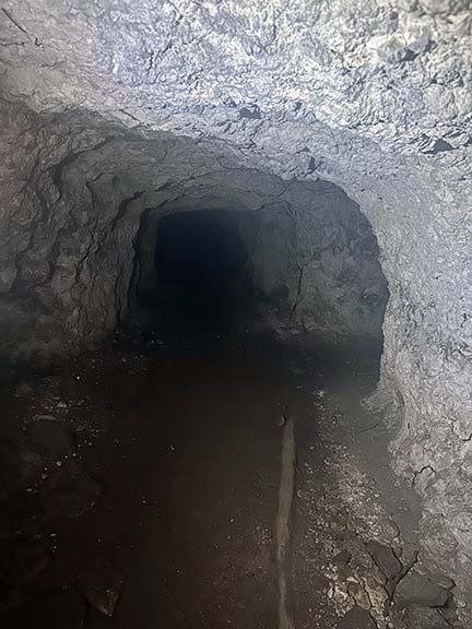
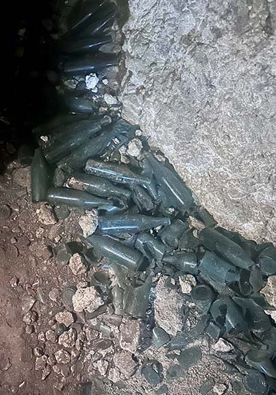
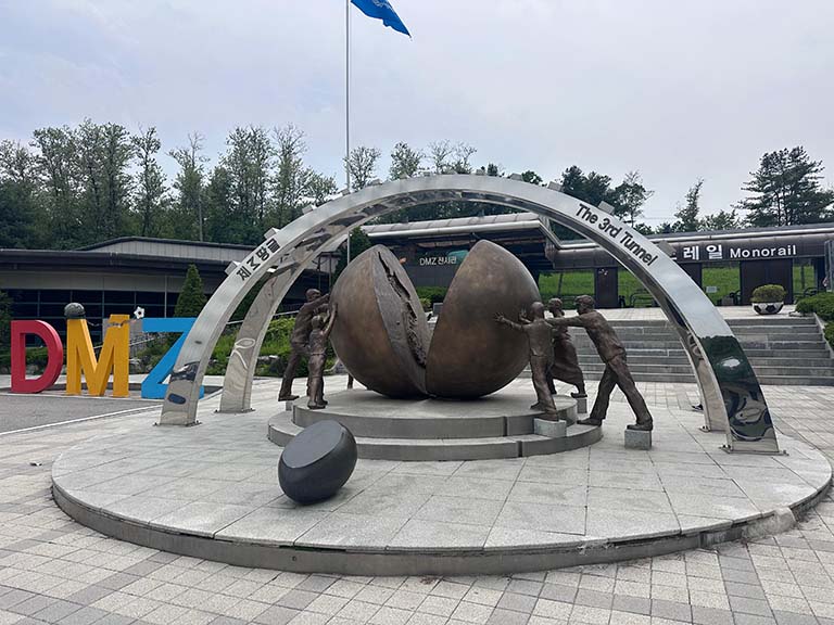
After that we cross into the Zone to the Third Infiltration Tunnel, “Third” meaning it was the third one found; it is believed that there are more yet to be discovered. These were dug with the objective of allowing tens of thousands of North Korean troops to bypass surface defenses and, without detection, invade the south. We don hardhats and traverse the cold, damp passage cut through solid granite some 240 ft underground. The full tunnel is a mile long, but is blocked off after 350 meters just shy of the actual border. No photos allowed.
|
|
|
I was hoping to get to the Joint Security Area at Panmunjom, having already visited it from a Northern vantage. That is where the building and conference table straddle the actual dividing line and North and South Korean soldiers face off. Alas, it has been closed to tourism for the last couple of years. The closest I get is the purachase of a pair of souvenir ceramic figures depicting a NoKo guard at attention and his counterpart in “RoK steady” stance.

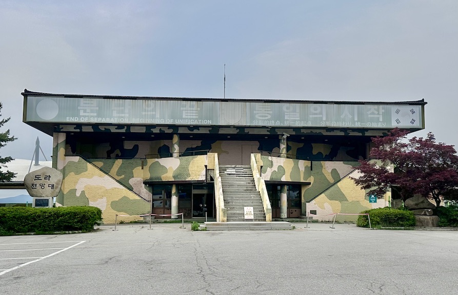
The final stop is the Dora observatory, right on the armistice line and affording a hilltop vantage of the entire area. We pass the old observatory building and visit the new one. Once, again, no photos allowed.
|
|
|
That’s it. Four places, two new countries, and three more flights to home.
Trip date: May 2025